Coon Mountain Preserve has two trails, the popular Summit Trail and the less-traveled Hidden Valley Trail. Both trails begin at a well-maintained trailhead on Halds Road in Westport. The preserve is owned by the Adirondack Land Trust and has a sign-in register. It also has a descriptive sign at the trailhead which talks about looking at a “working forest” but that is now inaccurate because the Land Trust has purchased that property and added it to the preserve.
Just after signing in, you have the choice of going straight for the summit on the Summit Trail or going left onto the Hidden Valley Trail which meets the Summit Trail after about ¾ mile where you have a choice of going to the summit or back to the parking lot.
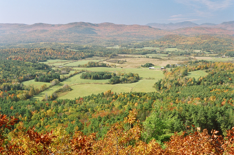
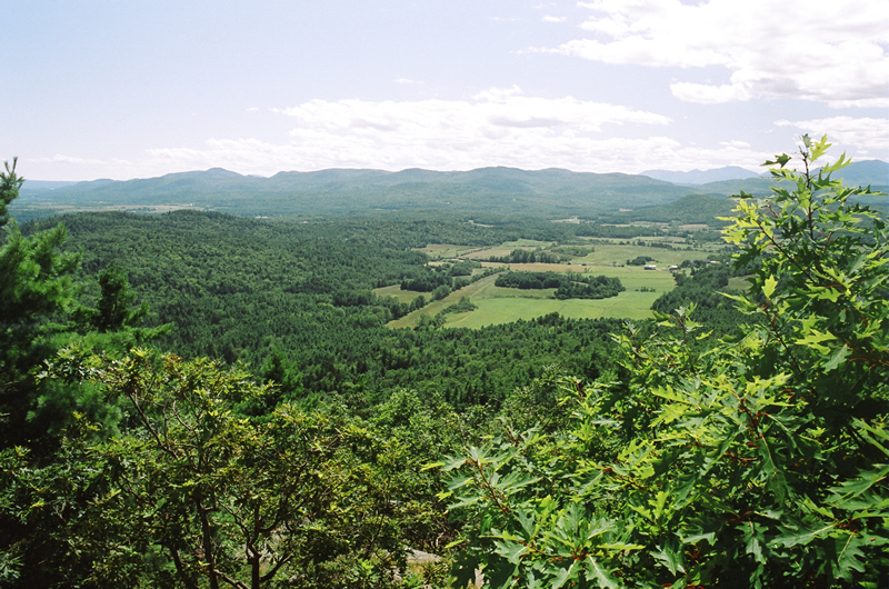
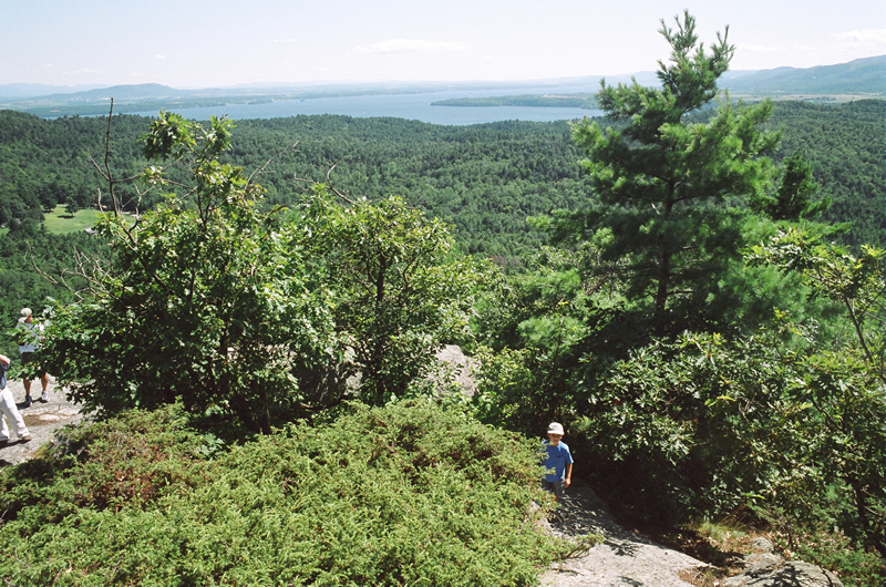
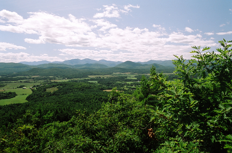
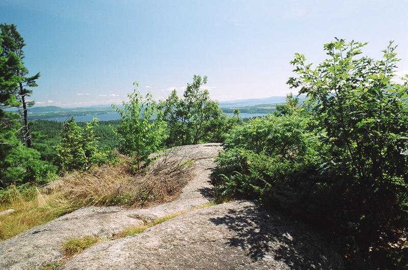
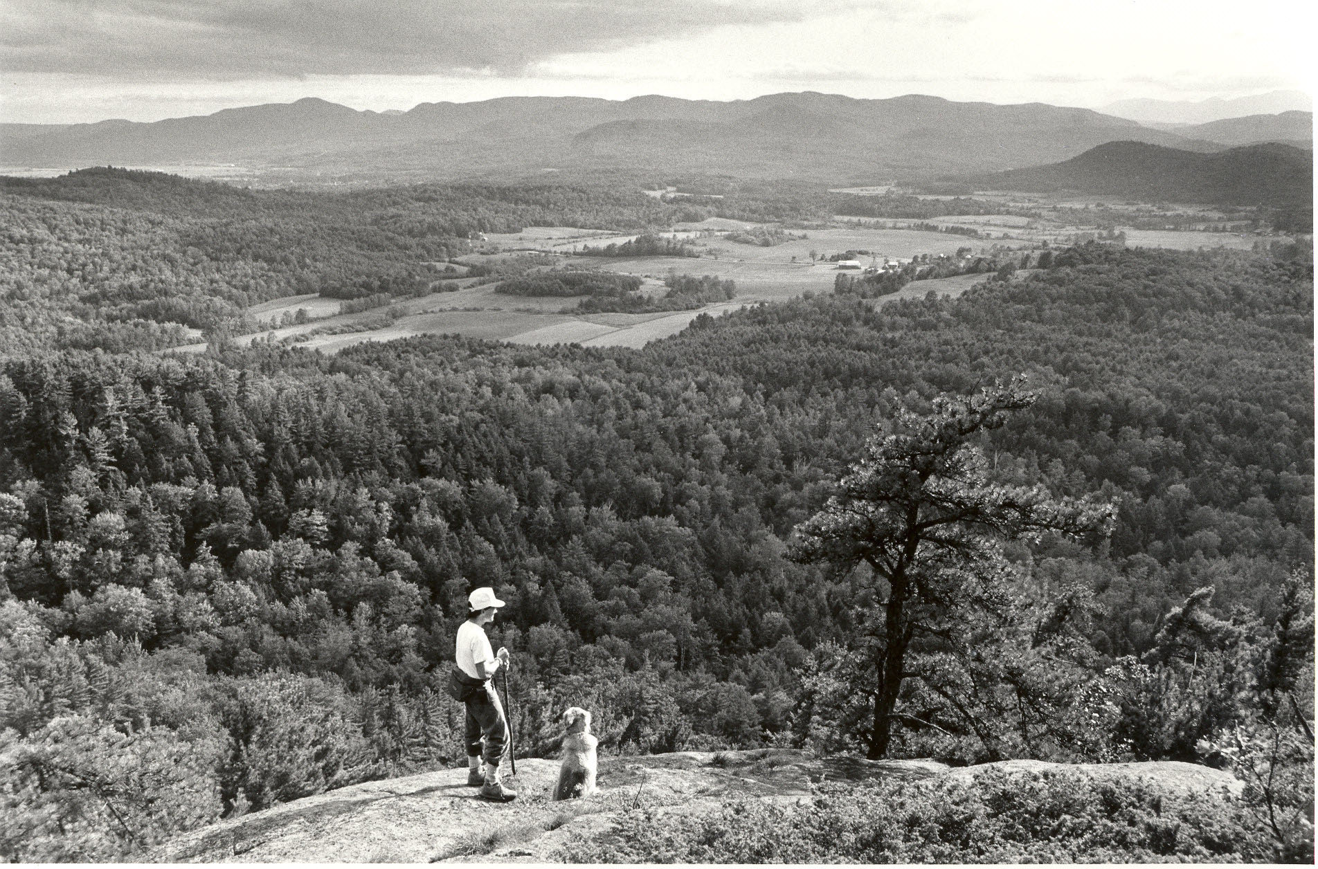
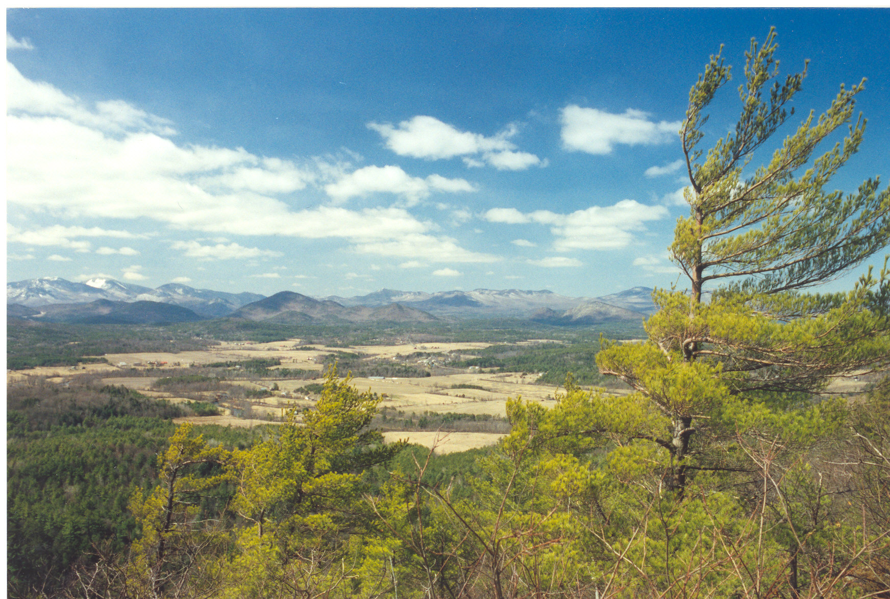
The Summit Trail follows an old logging road and then slowly climbs through a beautiful forest with large rock outcrops on your left. Eventually you get to a stairstep ravine, where you walk up a ravine on rocks arranged into stair steps. If it is wet, there will be a small stream flowing next to you. At the top of the ravine, the trail levels off as you walk below a stunning cliff. The trail continues climbing through this flatter part of the ravine and eventually gets to an upland section that winds through oak-hickory woods, along some wet areas, and finally makes its approach to the summit, where there are fabulous views of the High Peaks, the Champlain Valley, Lake Champlain, farmland, and even a beaver pond.
The Hidden Valley Trail goes to the left just after the registration box. It passes below a grassy oak-hickory-hornbeam forest community and soon enters the hidden valley. Here there is a richly-diverse forest with a great variety of trees, and in wet seasons, a host of mushrooms. There are rock formations and cliffs along the base of Coon Mountain. The trail climbs to the beginning of the valley, than passes over a small hill and meets the Summit Trail.
Location of Trailhead: On the north side of Halds Road in Westport.
Directions from Westport: Take Rt. 22 north. Just past the Westport Boat Launch, turn right onto Lakeshore Road. Go about 3.5 miles to Halds Road. Turn left and go about 3/4 mile to the trailhead.
Directions from Essex: Follow Lakeshore Road south about 7.5 miles to Halds Road. Turn right and go about ¾ mile to the trailhead
Directions from Wadhams: Take Rt. 22 north about a mile to Morrison Road. Turn right and after crossing the Boquet River, continue straight onto Halds Road. Go about a mile to the trailhead, which in on your left..
- Features of Trail: The views from the overlook are fabulous with farms and forests laid out below you, Lake Champlain in the near and distant view, and the High Peaks inviting you to come and explore.
- Sights and Natural Features: The Summit Trail passes by a seasonally-wet woods with large ferns and climbs through a mixed hardwood forest to the ravine. Look for the tree with a large “burl” which is a bowl-shaped growth on the side of a tree. The ravine is a wonderful place with cliffs on both sides and the rocks arranged like stairs. As you approach the summit, you walk on a narrow ledge on the mountain’s rock surface. And then the view is truly amazing. The Hidden Valley Trail offers a peaceful and intriguing hike through a mature forest with rocks and cliffs at the base of the mountain. It passes through diverse forest communities.
- Links - here are some links you might want to check out:
http://www.youtube.com/watch?v=psyXLC4-zXs ;
- Trail Length: This trail is about 2 miles round-trip.
- Trail Type: The Summit Trail is a there and back trail with an alternative route on the Hidden Valley Trail. The Hidden Valley Trail can be a loop if the hiker chooses to return to the parking lot. But by turning left, you can get to the summit.
- Trail Difficulty: Moderate to difficult. The ravine is the difficult part, especially coming down, when the rocks can be slippery.
- Trail Condition: The trail is in good shape; the steep rocky stairsteps can be slippery. It is more difficult to come down than go up the stairsteps.
- Parking: A nice parking lot; it does not have a sign by the road.
- Animal Signs: There are a variety of animal tracks visible in winter. There are porcupine dens on the Hidden Valley Trail.
- Other: The Adirondack Land Trust's trail guide is attached below but it needs some updating because it does not show the Hidden Valley Trail.
- Location: Westport, NY 12936
- Last Updated: September 18, 2011
| Attachment | Size |
|---|---|
| Coon Trail Guide.pdf | 244.26 KB |
| Coon Mountain 2.jpg | 406.77 KB |
| Coon Mt. - View south of farm in fall.jpg | 562.88 KB |
| Coon Mt. - View South of Sherman Farm.jpg | 502.23 KB |
| Coon Mt. - View south toward lake.jpg | 583.12 KB |
| Coon Mt. - View west.jpg | 480.23 KB |
| Coon Mt. Summit.jpg | 502.26 KB |
| Coon.Randorf b&w 1.jpg | 786.54 KB |
| coon view west 8.jpg | 698.85 KB |

