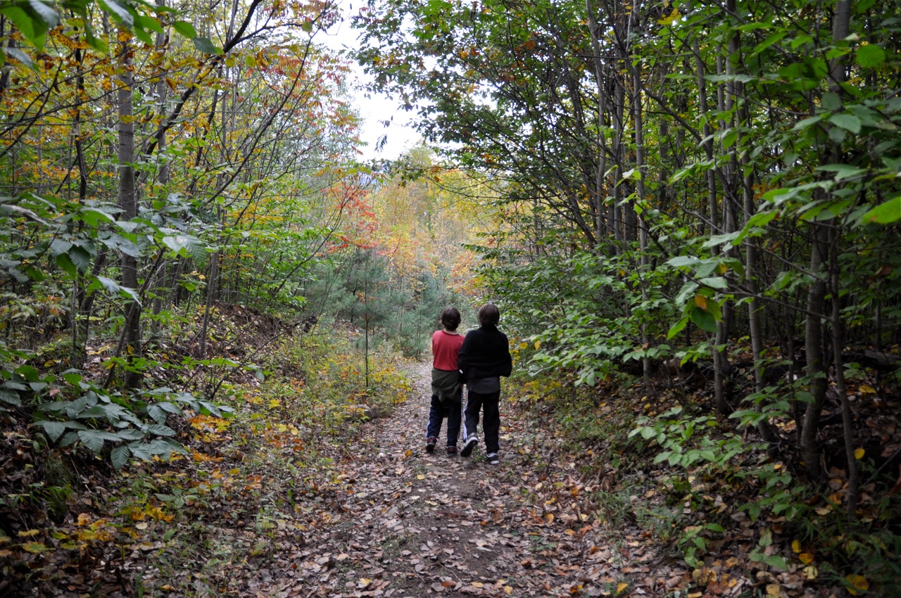
The Wildway Overlook Trail features an outstanding view after a relatively easy climb to the overlook. The trail follows an old logging road through an attractive forest of small trees recovering from a heavy timber cut. It slowly climbs in elevation with a few moderately steep areas that are relatively short. The trail is in good shape except during and after heavy rain when the water flows in old ruts left by the logging trucks and a single ATV which trespassed a few years ago. As the trail gets near the summit, it leaves the logging road and follows a narrow path through the woods. It passes through a unique forest community described below and comes out on the amazing overlook. You will return the same way you came up.
Location of Trailhead: The trailhead is on the east side Brookfield Road in Essex. It is 1/4 mile south of Jersey Street and one mile north of Cook Road.
Directions are below:
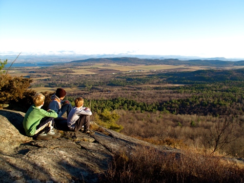
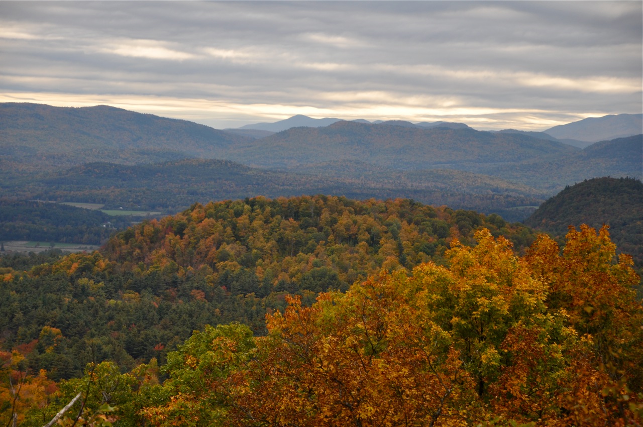
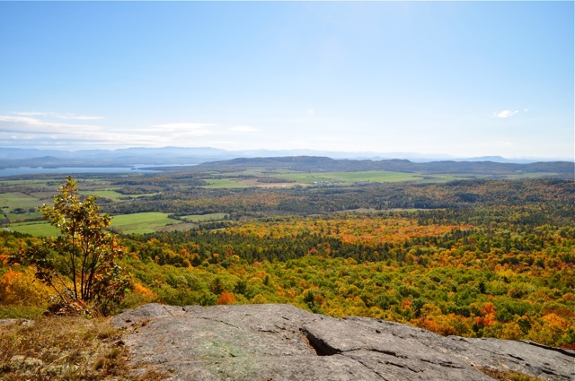
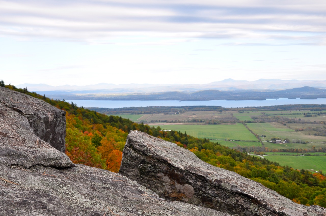
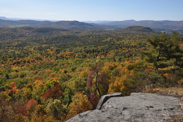
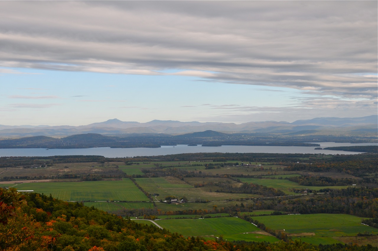
- Best Feature of Trail: A fabulous view of the Champlain Valley after a relatively easy hike. Looking east and south, the forests and farms of Essex spread out below you and meld into Lake Champlain and the Green Mountains of Vermont. Then looking south, the forests connecting Split Rock Wild Forest to the Adirondack Mountains become apparent. This is the Split Rock Wildway, the forested wildlife corridor connecting Lake Champlain to the Adirondacks. Looking southwest, you get a glimpse of the Adirondack foothills before the view is obscured by trees.
- Sights and Natural Features: Just before coming to the overlook, the trail passes throug a “dry calcareous oak-hickory-hornbeam forest” natural community which means it is a forest dominated by oak, hickory, and hornbeam trees growing on dry, limestone soils. The forest is an “open forest” with more widely-spaced trees. This allows more sunlight to reach the ground which encourages grasses and greater varieties of flowering plants to grow. This forest community is on south-facing slopes and summits and is one of the most biologically rich forest types in New York State.
- Trail Length: This trail is about two miles round-trip.
- Trail Type: There and back trail
- Trail Difficulty: Mild to moderate hike; actually an easy hike to a great view
- Trail Condition: Follows an old logging road; firm footing; may have flowing water during and after rain
- Parking: Roadside parking
- Animal Signs: The overlook is a good place to see soaring birds like turkey vultures and ravens. Winter hikes reveal many animal tracks.
- Location: Essex, NY 12936
- Last Updated: September 8, 2011
Directions:
From Essex: Go west on NY-22 about 2.5 miles to a sharp left turn. Continue straight onto Jersey Street (CR-12), cross the Boquet River, follow the road to the right as it goes about 2.5 miles to a stop sign. Turn left onto Brookfield Road and go 0.7 miles to the Trailhead, about 0.25 miles past Reynolds Road.
From Wadhams: Starting at the Dogwood Bakery, go north on Lewis Wadhams Road (CR-10) about 1.2 miles to slight right turn onto Walker Road (CR-55). When Walker Road turns right, go straight onto Power Road about 0.5 miles to where it makes a “T” with Brookfield Road. Turn right and go 1.6 miles to the trailhead. If you go to Reynolds Road, you have gone too far.
From Lewis Exit 32 on the Northway (I-87): Go east on CR-12 about 5 miles (CR-12 is Stowersville Rd. in Lewis and becomes Jersey St. in Essex) and follow it as it makes a sharp right turn (still Jersey St.). Where CR-12 makes a sharp left and remains Jersey Street, continue straight onto Brookfield Road for about 0.7 miles to the trailhead, which is on your left, about 0.25 miles past Reynolds Rd.
From Westport: Go to Wadhams and follow the directions above.
From Willsboro: Go to Essex and follow the directions above.
| Attachment | Size |
|---|---|
| Boquet Mtn, WWO, BK trails_ June 2011.pdf | 653.92 KB |
| Trails from Walker to Ferris Rds_June 2011.pdf | 1.02 MB |
| children enjoying the view.Jill_.jpeg | 440.73 KB |
| children enjoying view.JPG | 118.08 KB |
| autumn view.jill_.jpeg | 355.45 KB |
| boys on trail.jill_.jpeg | 613.88 KB |
| view east autumn.jill_.jpeg | 107.22 KB |
| view east w rocks.jill_.jpeg | 302.68 KB |
| view south.jill_.jpeg | 127.4 KB |
| view south.JPG | 1.01 MB |
| view w camel's hump.jill_.jpeg | 220.71 KB |

